Southern Thomson Phase 2 Survey
The Southern Thomson Phase 2 survey comprises acquisition, processing, and supply of an estimated 2,415 line kilometres of airborne electromagnetic, magnetic, and elevation data. The survey will fly along a series of evenly-spaced parallel profiles: the nominal line spacing is 5000 metres using the VTEMTM plus system.
The objectives of the Southern Thomson survey Phase 2 airborne electromagnetic (AEM) survey are to map, at a reconnaissance scale:
- trends in regolith thickness and variability,
- variations in bedrock conductivity, and
- the continuity of key bedrock (lithology-related) conductive units under cover.
The Southern Thomson survey Phase 2 is expected to be completed shortly.
Learn about Geotech’s survey for Geoscience Australia in 2014: Southern Thomson Project
East Isa Project
The East Isa Project comprises acquisition, processing, and supply of an estimated 15,695 line kilometres of airborne electromagnetic, magnetic, and elevation data. The survey will fly along a series of parallel profiles: the nominal line spacings are 2,000, 2,500, and 5000 metres using the VTEMTM plus system.
The objectives of the East Isa airborne electromagnetic (AEM) survey are to map, at a reconnaissance scale:
- trends in regolith thickness, character, and variability,
- variations in bedrock conductivity,
- the continuity of key bedrock (lithology-related) conductive units under cover, and
- the groundwater resource potential of the region.
The East Isa project is expected to commence this month, after the Southern Thompson Phase 2 survey is completed.
To meet the survey objectives, Geotech will be flying the VTEM™ plus time-domain electromagnetic system. This system is most suitable for this resistivity and structural mapping task, since it has a single transmitted waveform that offers continuous coverage over the survey area, producing focused, high-resolution data both laterally and vertically. The high quality data from the very early through late off-time gates combined with the low noise thresholds of the Full-Waveform VTEM™ system provide it with sensitivity to a wide-range of resistivities and conductivities from surface to depth.
A unique advantage of the VTEM™ Plus system is its on-board Horizontal Magnetic Gradiometer that will provide enhanced sensitivity to small variations in magnetic susceptibility, offering greater detail for structural interpretations.
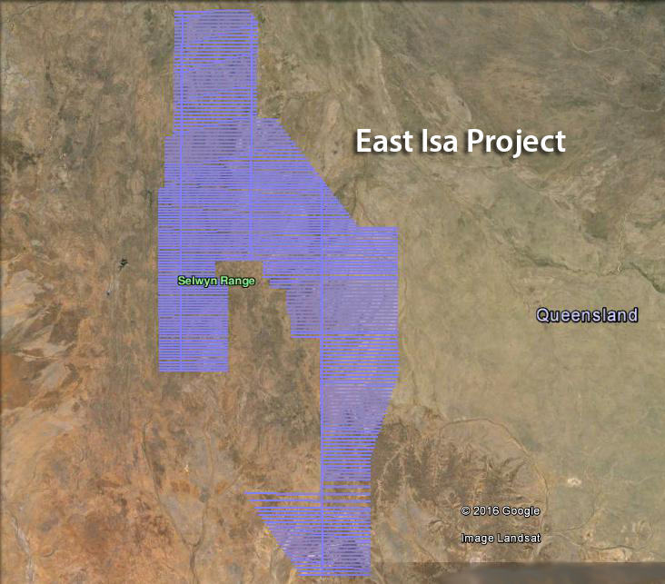
East Isa Airborne Electromagnetic (AEM) VTEM plus Survey flight path
Learn about Geotech’s 2014 Southern Thomson survey for Geoscience Australia:
Project Deliverables: Southern Thomson Orogen VTEMTM plus AEM survey
Project Deliverables: The Southern Thomson Orogen VTEMplus® AEM Survey: Using airborne electromagnetics as an UNCOVER application